That such a Northwest Passage should exist at all was considered a piece of inescapable logic. Since Aristotle, geographers subscribed to a philosophy of a balanced earth: that the same amount of land must appear in the northern hemisphere as the southern, that features present in one area would be mirrored in all others. This theory had already produced results. The long-sought terra australis, a large continent in the south required to balance Europe and Asia in the north, was found by Dutch sailors in the South Pacific in the 17th century; thus would Australia get its name. So too, if a southern passage existed around South America at Tierra del Fuego, naturally a corresponding waterway must exist in the north.
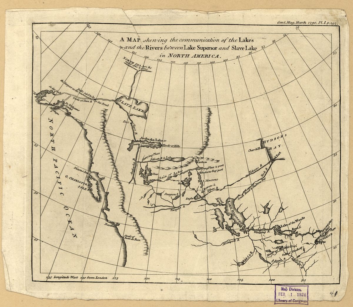
By the 1780s, sailors had probed all the crannies of Hudson’s Bay and the many straits around Greenland, and found every way blocked by ice. Thus, many geographers believed that the Northwest Passage must be a river through the continent, rather than a strait around it. One theory held that the Saint Lawrence River must be one end of this inland passage, and Cook’s Inlet at Alaska the other. Voyageurs and fur traders had uncovered the eastern portion of the route, from Quebec to Great Slave Lake, but it was up to Mackenzie to find the rest. This imagined waterway was called the River of the West, or sometimes the River Ouregan. And in 1787, Alexander Mackenzie met a man who thought he had found it.
Mackenzie spent that long winter with a haggard fur-trader named Peter Pond. While they were snowed-in together at a remote fort, Pond spun tales of a potential Northwest Passage. He was an amateur mapmaker, and constantly sought to fill the blank spaces in his own charts by quizzing his indigenous trading partners. One such chief, Awgeenah, told him an incredible story of a wide river that flowed into the setting sun.
Awgeenah often worked along Great Slave Lake, trading with the Yellowknife tribes that lived on the north shore. They told him that a mighty river flowed out of that lake to the west, directly to the sea. When Pond heard this, he drew a new map of the area. Captain James Cook had just surveyed the western coast of North America, and at the point where Anchorage, Alaska, now sits, reported a large inlet of unusually fresh water, choked with riverine driftwood. Pond put two and two together: Awgeenah’s river flowed to the Pacific, Cook had found its mouth. After centuries of searching and speculation, Pond believed the Northwest Passage was finally within reach.