
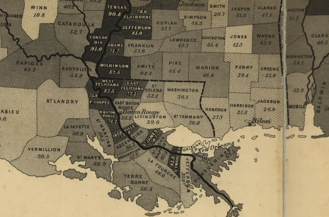
In September of 1861, the U.S. Coast Survey published a large map, approximately two feet by three feet, titled a "Map showing the distribution of the slave population of the southern states of the United States." Based on the population statistics gathered in the 1860 Census, and certified by the superintendent of the Census Office, the map depicted the percentage of the population enslaved in each county. At a glance, the viewer could see the large-scale patterns of the economic system that kept nearly 4 million people in bondage: slavery was concentrated along the Chesapeake Bay and in eastern Virginia; along the South Carolina and Georgia coasts; in a crescent of lands in Georgia, Alabama and Mississippi; and most of all, in the Mississippi River Valley. With each county labeled with the exact percentage of people enslaved, the map demanded some closer examination.
The Coast Survey map of slavery was one of many maps drawn from data produced in 19th-century America. As historian Susan Schulten has shown, this particular map was created by a federal government agency from statistics gathered by the Census. Abraham Lincoln consulted it throughout the Civil War. A banner on the map proclaims that it was "sold for the benefit of the Sick and Wounded Soldiers of the U.S. Army." The data map was an instrument of government, as well as a new technology for representing knowledge.
Though thematic mapping had its origins in the 19th century, the technique is useful for understanding history in our own day. One of the fundamental problems of history is scale: how can historians move between understanding the past in terms of a single life and in the lives of millions; within a city and at the bounds of continents; over a period of days and over the span of centuries? Maps can’t tell us everything, but they can help, especially interactive web maps that can zoom in and out, represent more than one subject, and be set in motion to show change over time.
To help show the big patterns of American slavery, I have created an interactive map of the spread of slavery. Where the Coast Survey map showed one measure, the interactive map shows the population of slaves, of free African Americans, of all free people, and of the entire United States, as well as each of those measure in terms of population density and the percentage of the total population. The map extends from the first Census in 1790 to the Census taken in 1860 on the eve of the Civil War. You can explore the map for yourself, but below I have created animations to highlight some of the major patterns.