In June 2022, as school was letting out for summer and nights were getting longer, a relatively obscure headline appeared in a few local papers and industry magazines: a 44-acre oil tank farm along Route 1A in Revere would be sold to a developer and transformed into a “state-of-the-art, technology-enabled warehouse.” The developers proposed, over the course of five years, draining millions of barrels of oil and demolishing 29 storage tanks, and replacing the facility with two warehouses totalling 668,500 square feet.1 The resulting Trident Logistics Center, according to the project’s proponents, would provide “hundreds” of jobs for the area, and significantly contribute to Revere’s tax base. The developer has described the project as an “opportunity to clean up the site” and to “deliver…the highest and best use for the property.”2
But the story hardly begins in 2022. For nearly a century, this site has been home to a highly toxic land use. Its soil and groundwater are likely so contaminated that building housing or even commercial buildings would require years of environmental review and remediation. Moreover, the tanks, and the future logistics center, stand on filled marshland: damp, low-lying, and extraordinarily vulnerable to coastal flood and rising sea levels. What else could be built here? And isn’t anything better than oil storage? From this perspective, building a logistics center seems like making the best of a bad situation.
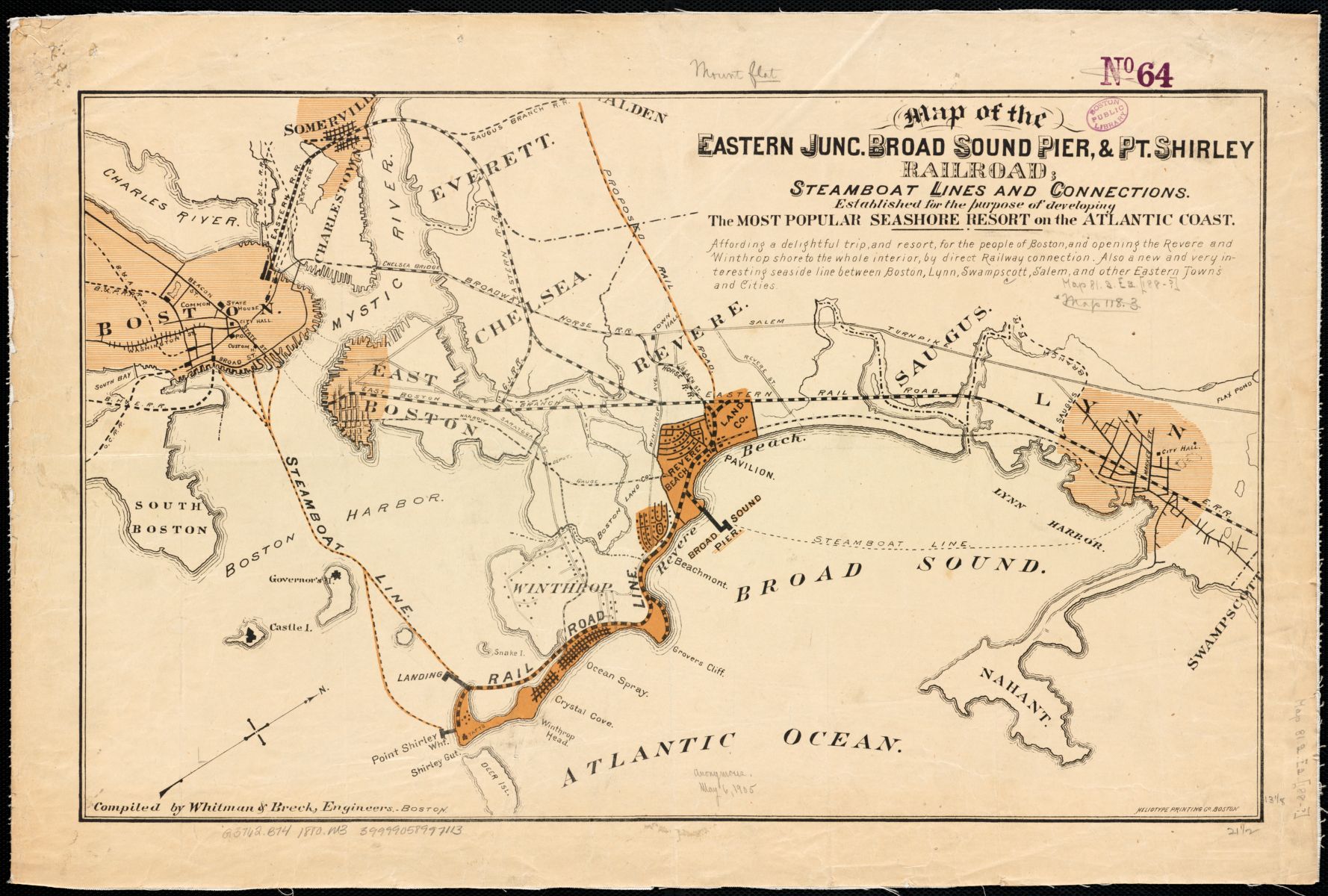
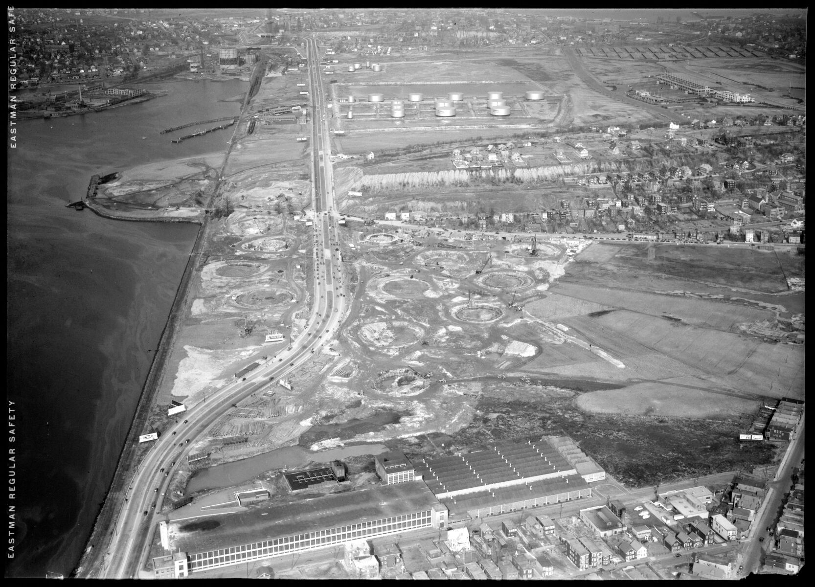
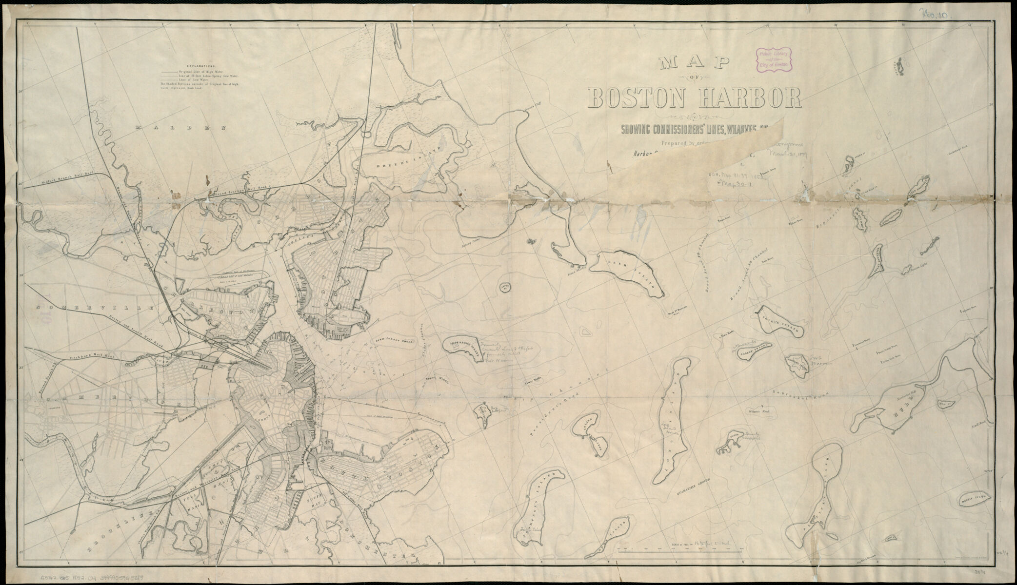
But that sense of inevitability is precisely why “sacrifice zones” like this one have long occupied the social and environmental margins of major cities. 95 years ago, nearly identical language was used to describe the same piece of land—which, in the early twentieth century, was not “land” at all, but a salt marsh bounded by Sales Creek and the upper reaches of Chelsea Creek. A group of developers proposed to improve the wetland by filling it, and topping the fill with the preeminent “center for fuel distribution for Eastern Massachusetts.”3 Their oil farm would be “the outstanding oil storage plant of the United States.”4 What followed was the site we know today: low-slung cylinders that store home heating oil and jet fuel.
The 21st century development of a logistics center, and the echoes of a long-ago justification of a former “highest and best use,” highlight the path dependency of harmful land uses and their attendant infrastructures, which were and continue to be built on sites with little perceived “value” or challenging building conditions. Where once the marsh was marginal and problematic because of its soggy nature, now the oil tank site is marginal and problematic because of decades of pollution.